Photo: Dario-Tapia
How Quito is building resilience into its mobility services
09 May 2017
by Jonathan Andrews
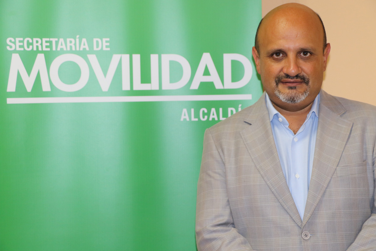
Jonathan Andrews spoke to Rubén Darío Tapia Rivera, Secretary of Mobility, Quito about the challenges of providing mobility services in a rugged and hilly city
Quito is constructing its first metro line. In such difficult topography and geology, how are you incorporating resilience into the plan?
As far as the metro is concerned, resilience is reflected in the ability to continue to operate and recover in the shortest time possible. Both the tunnel and the stations are constructed of reinforced concrete–material that has excellent resilience to earthquakes, fire or flood. The metro’s electrification system has redundancy characteristics, which allow the system to be up and running even if some of its components come out of operation.
The communication system is independent and exclusive to the metro, which means the metro will continue to operate or be able to recover more easily. Finally, if any of the automatic components fail in the railway signalling system, there is the possibility of operating the system manually once the emergency is over.
The first line of the metro as part of the city’s mobility infrastructure, becomes a strategic component within the city’s resilience strategy because it will provide better mobility conditions for Quito and also allow reorientation of certain tendencies of urban development that make the city vulnerable. For example, this strategy will help reverse the trend of horizontal, informal growth by developing vertically where the city has already installed infrastructure and mobility, through the first metro line. The metro not only solves a mobility problem, but also other social, environmental and economic problems.
Quito has to be resilient to solve social problems like the lack of jobs. During the construction of the first metro line, sources of employment have been generated and in the future economic development poles associated with the line will be generated. In the environmental aspect, a balance of the ecosystem services of the city (air, water, soil) will be sought, for example a reduction in private car travel which is reflected in CO2 reduction, transformation of exclusive roads for vehicles on bike paths, pedestrian-friendly tracks. That will be part of the city’s resilience strategies.
Has your membership of 100 Resilient Cities assisted?
Only 17 cities in Latin America have been selected and within Ecuador, Quito is the only city that is part of the network.
As a first step, a diagnosis of the city’s resilience was made and a resilience strategy will be presented in November 2017. The first metro line was identified as a fundamental part of this strategy which aims to address urban development around the first line as an inclusive, environmentally friendly development catalyst and with a number of additional urban advantages within this plan.
Quito municipality has formed the Metropolitan Resilience Directorate as part of the Metropolitan Urban Planning Institute (IMPU) whose goal is to define the municipality resilience strategies until the end of 2017.
Cities with a similar geography, like Medellin, have implemented Metrocables. Quito is constructing its own version, Quito Cables. Did you study Medellin’s example as a case study?
The city of Medellin is a world reference regarding the incorporation of cable systems (cable cars) for public transport. Therefore, this experience was one of the best case studies for Quito because of the physical and social characteristics of the city and its inhabitants that closely resemble those of our city.
As part of an exchange of experiences, several visits were made to Medellin in order to establish close links with the municipality to have the widest possible knowledge, both in the previous planning stage and in the development and operation of the system of Metrocables and its integration with the metro of Medellin.
We learned about urban planning around the stations of the Metrocables system, a fundamental aspect for the social and economic development of depressed neighbourhoods located in the upper parts of the city.
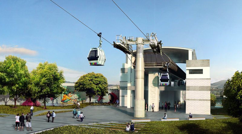
When is it due to be opened and how is it financed?
The contract was signed with the Army Engineers Corps for the construction of the first line of Quito Cables, Ofelia-Roldós, and was established for 16 months, a term that began on 5 December, 2016. The project is due to be completed in April 2018. However, there are many legal and regulatory difficulties that are still being resolved, so that date will be probably be extended until the end of 2018.
Citizens against the project say that public land is being taken to construct it and that the cabins will pass too close to their houses. How have you placated their concerns?
Intense work is being done to establish agreements with the neighbourhoods close to the project.
We are analysing the norms according to land uses by the Secretariat of Territory, Habitat and Housing and engaging with citizens and explaining the project in order to establish agreements with people that are worried.
Studies related to land use specifications are being carried out in order to establish that for lands where no buildings are built the normative will allow the construction of buildings of less height, unlike the rest of the neighbourhoods which are not located close to the Quito Cables line.
What smart city capabilities are you implementing in Quito’s mobility options?
As part of our smart city capabilities, the app MovilízateUIO has been developed in two components: 1) to provide information to the public transport user and 2) crowdsourcing.
The first keeps Quito’s public transport user informed about the lines and frequencies of public transport, both integrated and conventional. The user can access an app where they are informed of the schedules, routes and frequencies of mobility options to get around in a more efficient way.
We are the only city in Ecuador that has this information service for users. The user has access to the information of the integrated BRT transport system, feeders and 200 conventional public transport lines. This allows the user to know which bus to take and the estimated time. This information is available within Google maps in addition to the MovilízateUIO app.
The crowdsourcing part allows the user to interact with the authority, through a localised geo interface, that reports events on the road or public space. Two-way communication is available and additional information of the type, and the gender and age of the person reporting the event, and location of the event is available. This has been set up by the Secretary of Mobility and the General Secretariat of Planning with support from the Information Management Direction.
Quito implemented its own version of BRT, Trolley bus, in 1995 but then later invested in a more formal BRT system. How have you integrated the two systems?
The joint operation of articulated trolleybuses with bi-coupled diesel buses has not been technically or operationally inconvenient, since the basic infrastructure with exclusive lanes and stops is the same as if it were used independently for each type of vehicle.
The only thing to consider with the bi-articulated units is the provision of left and right doors, so that they can adapt to other corridors of the city of Quito.
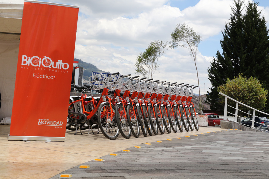
In cities with such a hilly terrain like Quito, is cycling a realistic option? Are hybrid/electric bikes an option to assist users around steeper hills?
The public bicycle system in Quito has been well received since its launch in 2012. According to the most recent information, during the last six months 8,395 users have used the service regularly.
The latest data shows that during weekends the use of the bicycle system drops by 70 percent, which shows that citizens, despite the topographical difficulties, consider the public bicycle system as a useful transport option. It is estimated that there are around 1,300 trips a day, not counting the 20,000 trips made outside the city’s BiciQuito system.
The municipality also purchased 300 electric bicycles that entered into the BiciQuito shared bicycle system in March 2016. The fleet consists of 297 bicycles (three are out of service due to incidents–without injuries or serious damage).
This demand is evident because, any assistance to pedal in the rugged topography of Quito is well received. Additionally, the municipality is in the process of implementing approximately 45 kilometres of new bicycle infrastructure, which allows cyclists to be more secure, especially when the geographic and climatic conditions are unfavourable.
What other mobility challenges are you facing due to Quito’s growth and location, perched on the Andean foothills?
The implementation of an integrated public transport system in the city of Quito and its urban area is in process. For this purpose, several strategic studies have been carried out and are under development, to take into consideration actions that will improve the quality in public transport services, including:
- structuring the tariff model of the metropolitan system of public passenger transport in Quito;
- restructuring of the routes of the public transport network of the Metropolitan District of Quito;
- expansion of the coverage and improvement of the quality of the public bicycle service in Quito; and
- improvement of the public transport services offered in the Central Corridor with the incorporation of 80 bi-articulated buses.