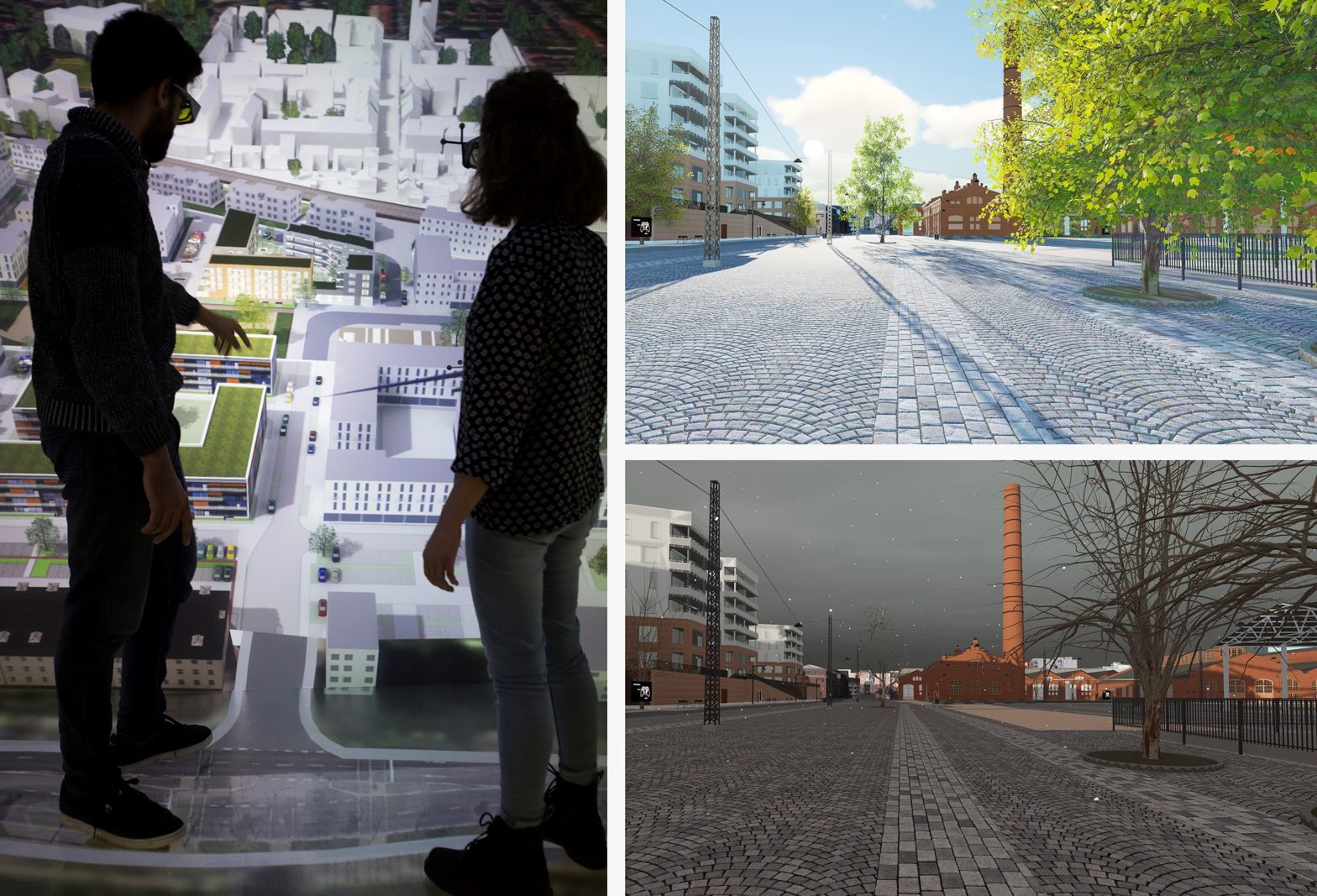
Photo: Fabian Dembski/TalTech/Lauri Lemmenlehti
Three cities on the benefits and challenges of digital twins
22 September 2022
by Sarah Wray
According to analyst predictions, over 500 urban digital twins are expected to be deployed by 2025 and the technology could save cities US$280 billion by 2030 through more efficient urban planning.
Some municipalities have launched digital twins while many others are still weighing up the pros and cons and considering their options.
Cities Today spoke to three cities about how they’re using digital twins, the benefits they’re seeing and the challenges along the way.
Why did you decide to adopt a digital twin?
Andres Maremäe, 3D specialist in the GreenTwins project, Tallinn: The short answer is to make better decisions. Data collection and capture is a relatively simple task due to the availability of affordable remote sensing technologies. The challenge is organising the data and using it in the decision-making process. A digital twin would help to handle the data as a whole and present it in a way that is easily consumable without deep understanding of the technology behind it.
In Tallinn, the need for a digital twin first arose in the urban planning and construction sector. More than ten years have passed since the first Tallinn 3D city model was created in the medieval old town area to popularise Tallinn for tourists. Soon it was also used in city planning, and now the 3D city model covers the entire city.
The 3D model of the city is a good starting point for developing a digital twin. The 3D city model is a visual component of a digital twin and although we don’t use it to visualise all the available data, it helps to grasp the concept more easily. It is important to emphasise that decisions must be communicated to the wider public, and 3D visual graphics are helpful.
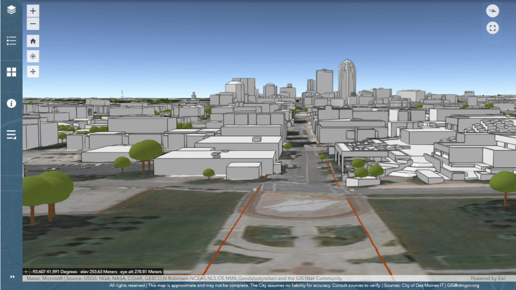
Aaron Greiner, GIS Manager for the City of Des Moines: As Des Moines continues to grow and add new buildings, we needed a modern solution to be able to analyse future development projects and their impact on designated viewsheds in the downtown area.
Adopting a digital twin provided us with an innovative solution to protect the view of the iconic golden dome of the Iowa State Capitol building from various downtown landmarks, such as our minor league baseball park.
As we work through development plans for a new Market District between the ballpark and the Capitol building, we’re able to visualise how new multi-use and residential buildings will potentially impact the sight line before they’re built.
Yoo Byoung Min, an officer in the GIS Division of Seoul Metropolitan Government (SMG) and manager of Seoul’s digital twin platform: The Seoul Metropolitan Government started the S-Map digital twin project to solve urban problems by simulating various environmental and development scenarios and to provide customised services in the field of culture and tourism.
With S-Map, there are infinite possibilities with simulation when you combine environment data with spatial data across Seoul in 3D. This not only maximises the efficiency of urban planning, redevelopment and reconstruction, but it also provides various customised map services to citizens.
What stage are you at with deploying the digital twin?
Andres Maremäe, Tallinn: In Tallinn we are at the beginning of the journey of digital twinning, but we are making rapid progress. Tallinn is in a good position because Estonia is technologically advanced, there is excellent cooperation with Helsinki, and the city’s strategy is to support the development and implementation of new technologies. The city leaders are aware of the importance of a data-driven decision-making process.
The digital twin roadmap milestones include capturing physical data on public roads annually using mobile laser scanning and imaging, and then extracting information on street signs, road markings and outdoor advertisements, etc.
Also, this year there are plans to start a project to collect and store underground utility networks to present them in the 3D city model and make asset management more efficient.
Various sensors have been installed and will be added to measure traffic and monitor energy consumption and climate in public buildings.
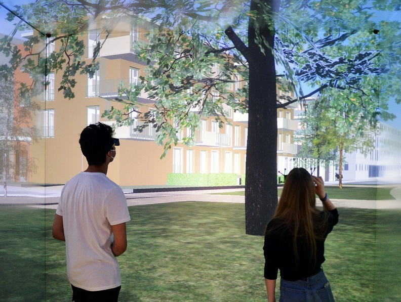
With the help of the international Green Twins project, we are adding a green environment data layer to the city model and developing digital tools for residents or NGOs to propose their own vision of urban planning. Additionally, a physical space is under construction that will allow citizens to use extended reality (XR) devices to enable co-creation.
Aaron Greiner, Des Moines: We started our digital twin initiative by focusing on building a 3D model of downtown Des Moines and the surrounding area, including detailed building models with roof and some wall structure added in. The remainder of the city outside of our initial focus area includes block building models with less detail.
With our initial digital twin created, we have been able to utilise this 3D base map with existing infrastructure datasets (utilities, transportation, etc.) and serve that information out in a couple of different web applications that our development staff can use to approach their workflows in a three-dimensional context.
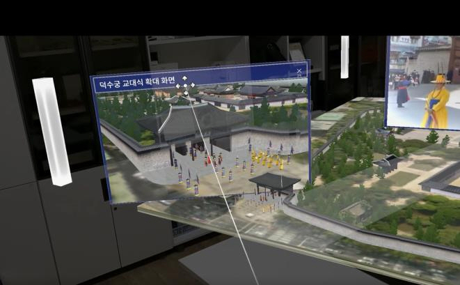
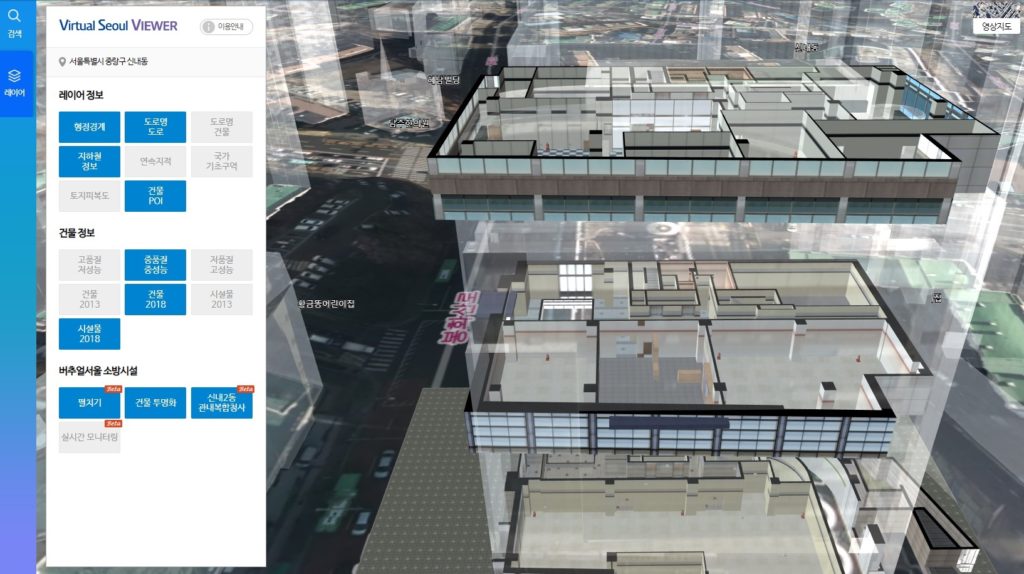
Yoo Byoung Min, Seoul: Virtual Seoul (S-Map) is a twin city that replicates the entire Seoul area (605.2 km2) in 3D in cyberspace. It is a digital twin system that can combine and even simulate information in a virtual space.
S-Map contains data on 600,000 ground structures like road bridges, overpasses and pedestrian bridges as well as underground facilities such as waterworks, gas piping, telecommunications, and heating systems.
Indoor features include public structures, subway stations and IoT-embedded fire extinguishing facilities. Geographical and contour maps, interpolation and surveying control points are also incorporated.
Functions include: 3D analysis for policy reflection, simulation diagnosis and prediction; integrated management and visualisation of 3D spatial information; and citizen participation.
Are you seeing any benefits yet?
Andres Maremäe, Tallinn: At the moment we have no methodological feedback that would show how the digital twin is useful, but we do have some examples of its use. In our medieval old town area, pedestrian traffic is monitored by sensors and the data is used to organise tourism activities. For example, restaurants can adjust their opening hours according to visitor dynamics.
In the detailed planning process, there have been some pilot projects with building information modelling (BIM) designs integrated into the 3D city model for the commission and city board to assess the proposed building in the context of the current situation. New 3D construction plans are also presented publicly to promote citizen participation.
Aaron Greiner, Des Moines: The digital twin of Des Moines, which we began developing in 2019, has simplified our workflows and improved the ability of our development services staff to discuss and present impacts that project proposals may have on our viewsheds. Unlike before, they can pull up the 3D map in real-time while on a call with developers to discuss potential concerns and save everyone time during the planning process.
Our development services staff have utilised the model multiple times for building proposals that have started to come in for the Market District and surrounding area.
In addition, our parks staff recently used the model to analyse site options for a future community garden. The digital twin provided information about the amount of shade cover from existing and planned buildings so that future gardeners could find enough sun and be successful in a new garden plot.
Yoo Byoung Min, Seoul: The city uses S-Map for urban planning and building evaluation to increase objectivity and to make evidence-based decisions.
Within the SMG, S-Map has been used to support the decision-making of the seven committees, including the Urban Planning and Traffic Impact Assessment Committee.
Wind paths across Seoul were also derived through S-Map. The wind path, strength and influence of topographical features are checked in 3D space and used for building layout, preventing the spread of forest fires, and reducing fine dust and heat island effects.
For citizens, we provide a non-face-to-face service that explains major tourist attractions with virtual reality through S-Map.
Where do you expect to see the most benefits in the future?
Andres Maremäe, Tallinn: Urban planning is simulated before any construction is carried out or before long-term decisions are made. In the simulations we can use real-world traffic data and take into account the opinions of residents.
Urban planning decisions will be presented in a more visual way and therefore citizens’ fears will decrease due to more transparent processes and the availability of information.
Aaron Greiner, Des Moines: We expect to see continued use in our development planning work, especially when analysing the impact surrounding structures and future construction will have within our neighbourhoods.
We also plan to work with staff from our other departments to find innovative ways the digital twin can benefit their workflows and simplify their needs.
Yoo Byoung Min, Seoul: This digital twin of the city will allow the SMG to make simulations to predict the impact of disasters and accidents, such as wildfires, and predict how new buildings and structures built in the city could interfere with the wind patterns of the area and possibly worsen fine dust pollution.
What are the challenges of getting the most from digital twins?
Andres Maremäe, Tallinn: Although there are many private companies and start-ups to develop some digital twin components, we still lack capable partners to develop new digital solutions. Software companies do not have enough software developers to meet the needs of the IT industry.
It is necessary to redesign processes in the city. These processes are often quite complex – for example, detailed planning is unique to each local authority.
And as always, there is the human factor. Habits are difficult to change and a culture of change must be managed delicately.
Aaron Greiner, Des Moines: Aside from construction of the model, the biggest challenge we face to getting the most benefit from our digital twin is figuring out methods in which the model can be leveraged to assist in other departmental staff’s work.
While it’s encouraging that our development services team has openly embraced new 3D modelling workflows, we need to continue the conversation with other city departments to fully realise the potential of this new tool in our toolbox.