Photo: EcoNet
New solutions for traffic management
19 June 2014
by Richard Forster
Cars, congestion and CO2–how can cities reduce all three while still allowing citizens the freedom of getting from A to B? Kirsty Tuxford looks at the role of information and communication technologies (ICT) in keeping traffic on the move
In March this year, the French capital Paris was forced to take drastic action in limiting car use when pollution spiked, hitting health-threatening levels. On 14 March, PM10 particles emitted by diesel exhausts, heating systems and heavy industry were to blame for a peak of 180 microgrammes per cubic metre, more than double the safe limit of 80. The authorities acted swiftly, banning traffic based on a system of alternating number plates, as well as offering free public transport and the use of the city’s Vélib and Autolib bike and car-sharing schemes.
Fortunately, a 60 percent reduction in congestion was reported by 17 March, and the level of PM10 particles in the Île-de-France region fell to between 40 and 55 microgrammes.
This is a scenario that more and more cities need to prepare for as the number of cars on the roads globally continues to grow, with the highest growth-rates seen in China, India and other parts of Asia. According to the International Energy Agency, an autonomous organisation that works to ensure reliable, affordable and clean energy, more than two billion vehicles are expected to be on the roads in 2050, an increase from approximately 800 million vehicles today.
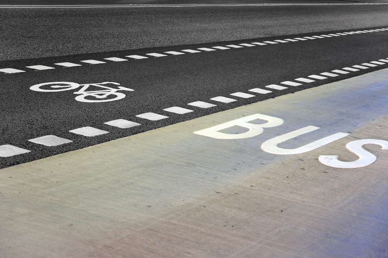
Car numbers are rising despite investment in public transport systems, car-pooling, cycle lanes and other means to reduce car use. Building wider roads only serves to increase the volume of traffic further, and so cities are looking to reduce congestion and pollution from private cars through the provision of alternative forms of low-emission transport such as electric vehicles (EVs); through the re-designing of cities as more pedestrian-friendly places; and by incentivising people to leave their cars. ICT can help in all these scenarios.
Electric vehicles and ICT
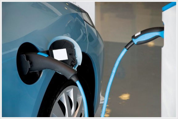
In terms of promoting the use of electric vehicles, Thales, a French technology company, has launched EcoNet® in Spain to help electric vehicle users find re-charging points for their cars.
Using a smartphone, or other internet-connected device, the driver can view the exact location of the nearest charging points on a map, find out if they are free or occupied, and pre-book a charging time, among other services.
Josu Irureta, Manager, North Regional Office, Thales, Spain, is also Head of EcoNet Solutions at Thales. He explains: “Choosing an electric vehicle is increasingly popular, but people are still quite reticent given the possible difficulties or doubts about charging. Questions such as knowing where to charge, how long it will take, points outside the habitual driving area, the state of the charging points, the charging system etc, all these hindrances to the development of the electric vehicle are now addressed by EcoNet®, as it provides advanced administration and monitoring functions for the charging network currently in service in Spain, thus placing it within anyone’s reach regardless of which operator the driver may have contracted.”
Alleviating congestion is also about convincing people to choose alternative forms of transport. Part of this battle can be won by providing the public with real-time information about multiple journey routes.
Various journey planner apps are available for smartphones, but in France where Thales is based, not one provides the bigger picture of all transport options in real time. Thales have designed an Innovative Urban Travel Planner app that not only provides information about conventional modes of public transport but also the availability of car sharing. In addition, the app offers real- time situation management across all public transport networks, private and shared vehicles and pedestrian routes. It monitors all events and recalculates routes to take account for passenger volumes and track-related incidents for rail travellers, traffic jams for road users and even last-minute changes by users.
The app uses travel data from various sources across the city and searches for transport options as they become available and then suggests the best itinerary. In the event of a breakdown or delay, it automatically proposes an alternative solution.
Currently in a prototype phase, the app monitors 41 million daily journeys in the greater Paris region and provides real-time assistance for up to one million commuters at any given time. The app has a big role to play in helping Paris realise a project announced in February by French Transport Minister, Frédéric Cuvillier, which aims to roll out a nationwide, multimodal route planner by 2015.
Congestion charging
One method to control congestion is to charge road users, which has been adopted by London, Singapore and Stockholm. Q-Free is a leading global supplier of products and solutions within ITS (Intelligent Transport Systems) and played a key role in the implementation of Stockholm’s Congestion Tax System.
“When this was implemented in 2005, it was a ground-breaking solution,” says Steinar Furan, Global Account Manager at Q-Free. “The effects of the system became immediately clear to everyone; the total traffic was reduced by over 20 percent and the travel time for journeys in the city was cut 30-50 percent. The effects exceeded the expectations of the customer, as they originally expected a reduction of 10 percent.”
In terms of road user charging or congestion charging, a city needs to be able to efficiently identify the vehicles and their properties. This can either be done using electronic transponders, OBUs, or through automatic licence plate recognition. Once the vehicle is identified and the vehicle’s registration data are known, the city can implement different traffic management applications to improve safety, to improve mobility and to reduce the impact on the environment. As an example, Stockholm saw a reduction of 14 percent in pollutants following the implementation of its congestion tax system.
The cost of such systems varies depending on local conditions. “What we can say is that the cost to achieve mobility improvements in Stockholm through other means than congestion tax would be at least 100 times higher and would take a minimum of 10 years to complete,” says Furan. “In reality, most of our systems pay back their own cost within a few months of operation.”
Q-Free’s solutions allow cities to better use existing infrastructure, without the need for investment in new projects. So, a quick reward in the form of an immediate improvement in traffic mobility is seen.
“An improvement in travel time of 20-50 percent can be expected,” says Furan. “And large funds are then made available for new mobility programmes and the city will save a lot of money on the reduced need for new road construction. What the city should consider, are the effects it wants to achieve, and then communicate this to its citizens. Experience from Stockholm shows a great public acceptance of the system, as more than 70 percent of the citizens support the congestion tax programme.”
Bluetooth to ease traffic
As with Q-Free’s solutions, other companies are realising that collecting data about traffic is the first step in managing its flow. In Malmö in Sweden, sensors along the road are measuring traffic by anonymously tracking Bluetooth and Wi-Fi devices, such as mobile phones, tablets and hands-free installations in cars. This makes it possible to measure travel time and calculate average speed. The solution, called BlipTrack, is the work of Danish company Blip Systems and Swedish partner firm, Peek Traffic, and the data collected enables the municipality to fine-tune the traffic signals to ensure a smooth flow of traffic.
Using the gathered data, traffic analysts can also predict where traffic is likely to build up and send out communications to drivers regarding hot spots to avoid and alternative routes available. This leads not only to significant economic benefits through reduced journey times and fuel consumption, but also reduced CO2 emissions and improved air quality.
“The solution looks very promising and is providing us with the data we want,” says Johan Irvenå, Traffic Analyst at Malmö Municipality. “The future will give us a much better overview on how we can utilise data in the best possible way.”
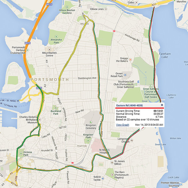
BlipTrack sensors are also in operation in Portsmouth in the UK. This time partnering with UK company Smart CCTV, Blip Systems has installed sensors on the three most-congested roads in and around the city. As with Malmö, data is being used by the city to regulate traffic flow and information about queues and alternative routes is communicated to drivers through VMS or mobile apps.
The Automatic Number Plate Recognition (ANPR) camera solution has also been used to monitor traffic flow but is more expensive. “BlipTrack catches upwards of 40 percent of vehicles, compared with 95 percent with ANPR,” says Smart CCTV Managing Director, Nick Hewitson. “But this is statistically more than adequate for journey time information.”
The need for Open Data
ICT obviously plays an important role in managing traffic flows, but in order for ICT to work effectively, real-time data on people’s movements must be freely available. This ‘Open Data’ concept is a hot topic in the world of urban transport right now, and was the focus of discussions at February’s IT-TRANS conference in Germany.
The International Union of Public Transport (UITP – Union International des Transports Public) reported on the event: “IT-Trans was the occasion for public transport professionals from around the world to gather and explore the innovative IT solutions that are transforming urban mobility. Amongst the new trends explored, like mobile ticketing, crowdsourcing social media applications or ITCS, the use of Open Data in public transport aroused the interest of most attendees.”
Systems that have already been developed to determine the location of vehicles, to apply tariff structures, or monitor the hourly and daily status of the transport system are of use in managing traffic flow–there’s no need for cities to invest in expensive new technology. They merely need to make existing information openly available–though it must be noted that open data does not involve sharing confidential customer information.
Transport for London (TfL) is widely hailed as a pioneer in the use of Open Data with a policy of “free and Open Data as the default”. Whenever a new product is developed, any data that lies behind it is made freely available.
TfL started opening up access to its data back in 2007. Now, this free Open Data is used by more than 200 travel apps covering all modes of transport and serves millions of customers. TfL itself does not usually develop the apps–only in cases when external developers can’t match business objectives or the required level of security.
Today, ICT has progressed significantly to enable effective traffic flow management in conjunction with the many alternative forms of transport now coming to the fore. However, ICT is redundant unless cites open up access to their transport data–only then can they be sure that they’re on the way to alleviating extreme pollution levels (such as those seen in Paris), and ensuring that residents’ daily commute doesn’t involve wasted minutes sitting in gridlock.