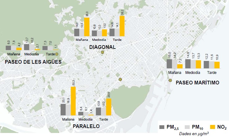
Photo: RACC-Zurich-BCN-Study
Mapping air quality
18 April 2019
Air pollution is a major problem for public health. The main sources of these pollutants are transport and energy followed by industry. According to the World Health Organisation, ambient air pollution kills over 4 million people every year, primarily in cities. The problem is on the rise due to unprecedented population growth in cities.
Despite the negative effects on human health, the economy, and the environment, traditional air quality monitoring stations available are too expensive to be scalable. They are spatially very limited due to the high capital cost per station, the associated operational annual cost and require large facilities. These few measurement points do not provide the real or complete picture of how air quality changes over time. We cannot solve a problem if we do not know about it.
bettair® is an IoT platform that can map air and noise pollution in cities on a previously unimaginable scale with a large deployment of incredibly accurate gas and other environmental sensors. The platform includes the hardware (gas sensor network), the software (back/front end) for cities and an app for residents.
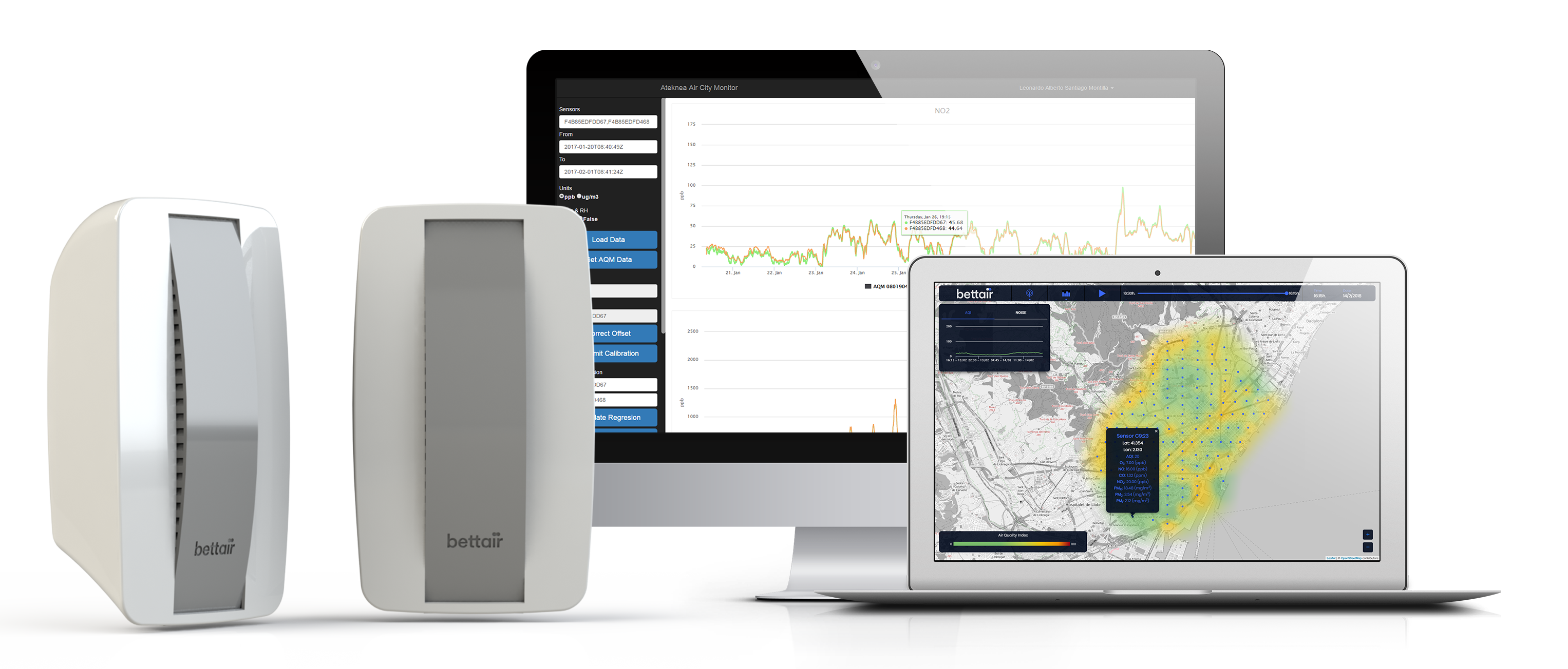 The bettair® platform, which complements the traditional equipment, helps to identify unknown pollution sources, assess the impact and effects of different environmental actions taken such as lowering the speed limit and traffic management, and finally the platform recommends specific local actions.
The information provided by the bettair® platform, provides unique insights and enables smarter and better decisions to mitigate air pollution in the short run. In the medium run, it is also a very powerful tool to define effective and appropriate urban plans to improve air quality. Additionally, it also helps cities identify and categorise zones per air quality. This information is very relevant and can be used by people with respiratory diseases, and joggers. Residents with the app are able to measure their individual exposure to air pollution and identify the cleanest routes. The possibilities are endless.
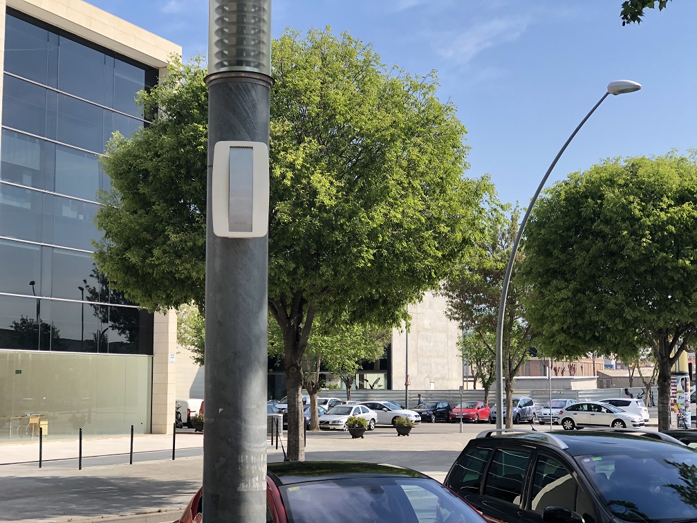 The technology has already been already tested in eight European countries. As an example, a new deployment has been carried out recently in the city of Girona (Spain) and the results have shown interesting insights as expressed by Jordi Xirgo, Head of the Territorial Analysis Unit in the City.
“bettair® allows us to understand how pollution behaves in zones not covered until now,” he said. “At last, we have been able to compare pollution in those different zones.”
Another example of the use of bettair® is the study carried out by RACC, the largest automobile association in Spain with around 1 million members, in conjunction with the Zurich Insurance company. A study of air pollution was done in five cities in Spain (Barcelona, Madrid, Seville, Malaga and Donostia/San Sebastian) to identify the cleanest areas and the most convenient time-table to jog. The study measured NO2 and particulate matters. One of the conclusions was that, depending on the location and time of day, the pollution exposure can be reduced by six to 10 times.
One of the recommendations that came out of this study was that cities should install a large deployment of measuring points, and that this information should be available to residents through an app.
The complete study can be found at https://bit.ly/2UyDLFy
Bettair Cities, Bettair Life, Bettair
Brought to you by:
![]()