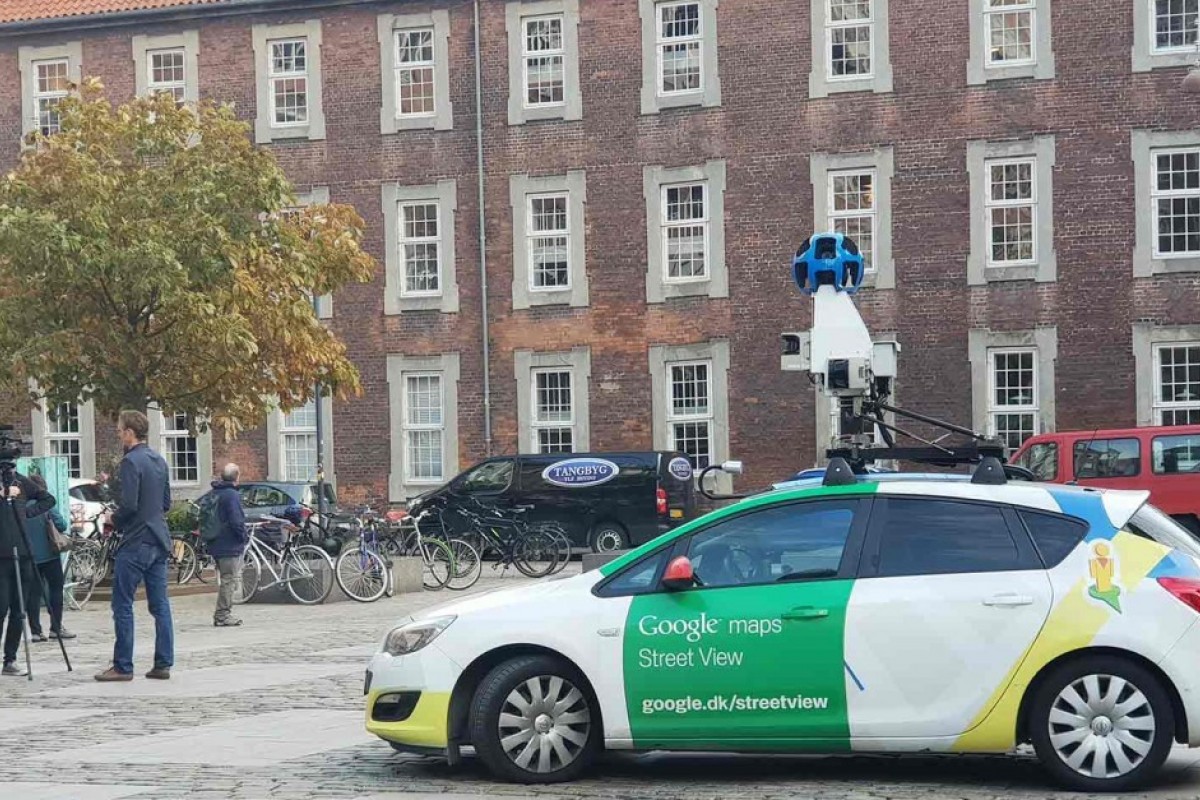
Photo: Google Copenhagen
Google Street View data pinpoints Copenhagen’s traffic pollution hotspots
27 May 2021
by Sarah Wray
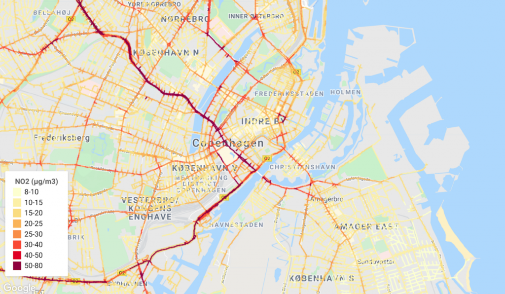
New air quality maps show that Copenhagen’s major access roads have nearly three times more ultrafine particles and nitrogen dioxide (NO2) and five times higher black carbon levels than quieter residential areas.
The insights have come out of a project with Google and Utrecht University, in collaboration with Aarhus University, to gather data via a Google Street View car fitted with advanced air quality measuring equipment.
A statement from the City of Copenhagen said: “In general, air quality has improved in Copenhagen in recent years, but this trend does not seem to apply to motorways and major access roads, according to Google Street View car’s measurements of NO2. It is also on the approaches that the concentration of ultrafine particles and soot is worst.”
The initiative is part of Google’s Project Air View which launched in 2015 and operates in cities including Oakland, Houston, London and Amsterdam. Copenhagen was the first European city to join in 2018. Over the past six years, Google said Street View cars have collected more than 100 million street-by-street air quality measurements. The data feeds into Google’s freely available Environmental Insights Explorer (EIE) tool to help cities reduce their emissions.
Hyperlocal data
More detailed air pollution insights and maps are being used to help Copenhagen plan the most effective interventions.
Copenhagen’s technical and environmental mayor Ninna Hedeager Olsen commented: “It’s the first time we get a fine-meshed network showing pollution right down to street-level and on all roads in all of Copenhagen. The differences become very clear and it gives us important knowledge about where we should concentrate our efforts to plan the city in a better way in order to protect the Copenhageners against the dangerous particles.”
The project is also the first time the city has been able to measure the concentration of ultrafine particles down to the street level. These particles of less than 100 nm are not included in official statistics as the EU has not set formal limit values for them, despite growing concerns about the risks they pose to health.
Further, measurements made with the Street View car are sampled in the middle of the roadway compared to previously developed maps and measurements, which are mostly measured at the side of the road or at building facades.
The analysis also finds significant ultrafine particle emissions near the airport. The Vesterbro area and the city centre have higher measured levels of air pollution than other parts of the city, which the municipality said can’t be immediately explained by traffic alone.
Apply some pressure
Olsen said the municipality will use the findings to put pressure on national politicians for more leverage to reduce polluting cars in the city.
“Christiansborg must give us the tools we need to ensure the health of Copenhageners. Give us the opportunity to regulate traffic, not only on the basis of C02 emissions, but also on the basis of criteria on which car types emit the most harmful particles,” she said, referring to the potential to introduce a detailed road pricing scheme and expand environmental zones to private cars alongside the lorries and vans which are currently included.
In the meantime, she said the focus will be on limiting vehicles and emissions through measures such as speed reductions and fewer parking spaces, as well as pushing for more cycling and walking routes away from car traffic and for new day care centres to be located away from polluting roads.
EV in Dublin
Dublin is one of the latest cities to join Project Air View and uses Google’s first electric Street View car. A Jaguar I-PACE car has been fitted with Google’s Street View technology as well as a mobile air sensing platform from Aclima that can measure and analyse pollutants such as nitrogen dioxide, nitrous oxide, carbon dioxide, carbon monoxide, fine particulate matter, and ozone.
Google plans to launch Air View initiatives in more cities and there is potential to expand its fleet of electric Street View vehicles but the company has not shared any specific details.
Project Air View’s air quality insights will also be integrated into the European Commission-funded European Expanse project, which is exploring how pollution impacts health and how hyperlocal air quality measurement efforts can inform policy development.