West Midlands cuts knife crime with data
11 July 2025
by Jonathan Andrews
West Midlands Police in the UK has reported a 16 percent reduction in knife crime across key areas of Birmingham, following the introduction of advanced geospatial analysis techniques designed to identify and respond more precisely to violent crime hotspots.
The new approach, developed in partnership with Esri UK and supported by the Home Office’s Hot Spot Action Programme, is led by a dedicated taskforce, Project Guardian. Established in 2024 to address serious youth violence and knife crime, the taskforce combines traditional policing with data-driven methods to focus resources on the areas of highest risk. With more than 7,000 knife offences annually, the West Midlands had the highest rate of knife crime per capita in England.

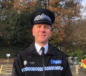
“The sharing of intelligence is through a variety of operational and strategic partnership frameworks,” David Amos, Chief Inspector, Project Guardian Force Lead, West Midlands Police, told Cities Today. “This allows for the creation of holistic problem-solving plans informed by police and partner data. By embedding a problem-solving approach across agencies, we can understand root causes, not just respond to symptoms.”
In the past year, the approach has led to 812 arrests, the seizure of more than 500 weapons, and an estimated £13 million reduction in the societal cost of crime. Using Esri UK’s geospatial tools, analysts are able to assess violent crime patterns at the street and property level, creating detailed maps and dashboards to guide targeted patrols.
Amos explained that the use of geospatial analysis has changed how the force works with city agencies.
“Geospatial analysis provides an enriched data set that allows stronger working with internal and external partners,” he said. “It helps to drive joint scanning and analysis phases, ensuring that responses are tailored, informed, and collaborative.”
He added that early stakeholder engagement allows all parties to begin from a shared understanding and “leads to a genuine feeling of partnership-led activity”.
Detective Chief Inspector John Askew, who leads Project Guardian, said the new tools have had a direct impact on operations.
“Our patrols can now act on intelligence from Esri tools and focus their attention on the right places. The latest figures reflect significant changes in how we police.”
Historic data from 2021–2024 was used to identify “risky facilities” such as transport interchanges, night-time economy zones and fast-food outlets. Informed by the SARA (Scanning, Analysis, Response and Assessment) model, analysts used 80/20 techniques to pinpoint the streets responsible for a disproportionate volume of incidents. The Weighted Displacement Difference Tool was also deployed to assess whether interventions reduced crime or merely shifted it elsewhere.
West Midlands Police plans to deploy a mobile patrol solution to improve intelligence reporting from the field.
“This next step will help us better understand real-time dynamics in hotspots and support ongoing assessment of our interventions,” added Amos.
Chris Gardiner, Head of Sector for Public Safety at Esri UK, noted: “West Midlands Police is among the first forces in the UK to elevate geographic analysis to this level. Its investment in new skills and technology is delivering more targeted and efficient outcomes.”
Images: West Midlands Police


