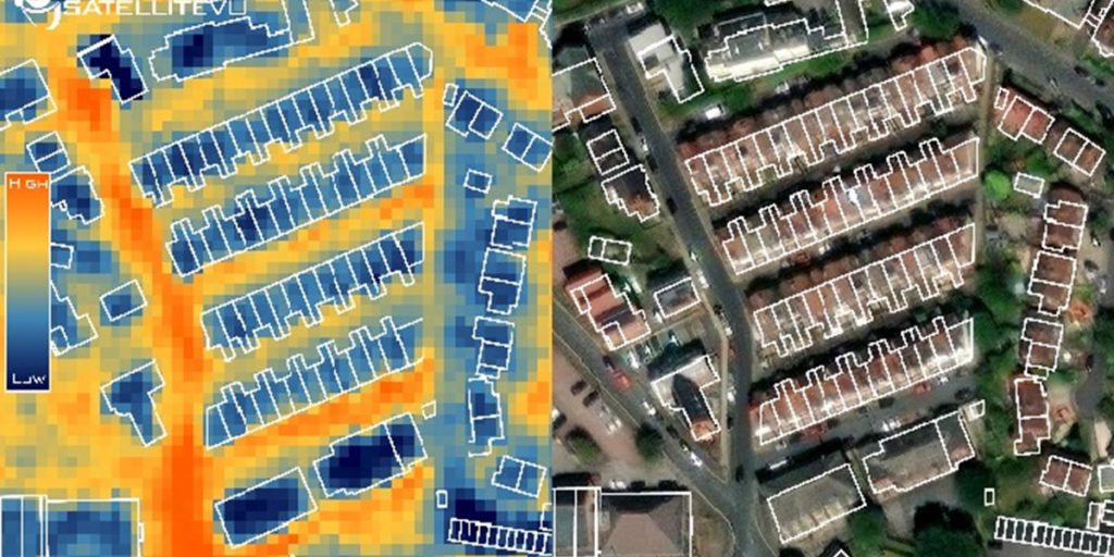
Photo: Satellite Vu
‘Flying thermometer’ helps Leeds prioritise building retrofits
09 May 2023
by Sarah Wray
New aerial thermal imaging technology has been used for the first time in the UK in Leeds to map the level of heat loss from individual buildings.
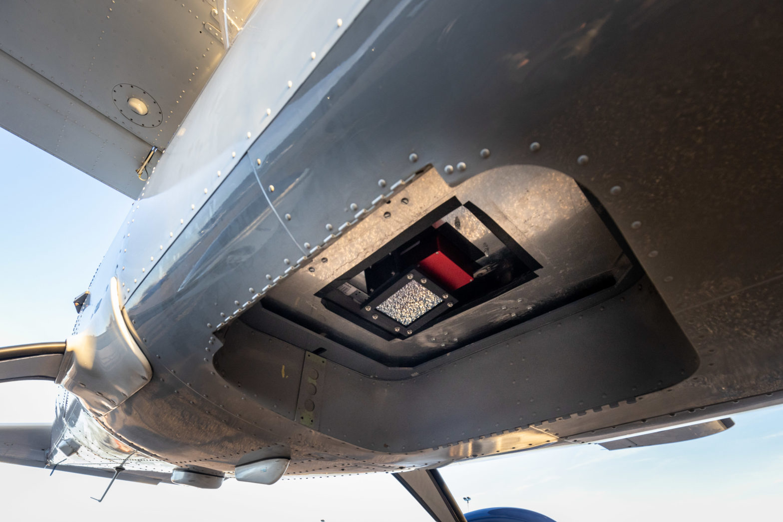
During a test flight, a specially equipped aircraft mounted with an advanced thermal imaging camera flew over Leeds to gather data.
According to Satellite Vu, its technology offers an “unprecedented level of detail and scale”, allowing local authorities to more effectively target funding for retrofitting homes.
Founded in 2016, Satellite Vu is aiming to be “the Earth’s thermometer from space”.
The company is launching a satellite constellation which it says is capable of measuring the thermal emissions of buildings in near real-time with high-resolution infrared cameras. The first of eight miniaturised satellites is scheduled to launch in June this year.
Decarbonising buildings
Leeds City Council plans to use the thermal imaging data in several ways, such as in programmes related to its Net Zero Homes Plan which sets out how the council will install low carbon heating and tackle heat loss from residential buildings.
Part of the plan is about improving understanding of the different retrofit technologies available and the impact they have.
The data could also be used to help understand heat loss from council-owned buildings, visually demonstrate the impact of the council’s previous energy efficiency upgrades, and show where buildings are underperforming relative to their neighbours in terms of thermal efficiency to encourage people and the private rental sector to upgrade homes.
New insight
Councillor Helen Hayden, Leeds City Council executive member for infrastructure and climate, said: “This is an innovative project that could transform our understanding of building heat loss at the city-level, potentially unlocking additional investment in energy efficiency measures that cut energy bills and help us tackle climate change.
“Leeds already has a strong track record of delivering energy saving improvements to thousands of homes in recent years, but we know that plenty more needs to be done. By giving us street-by-street insight about heat loss, this new technology could help us do just that.”
The flight was funded by the MCS Charitable Foundation which works to accelerate the adoption of renewable energy and low carbon technologies.
Dr Richard Hauxwell-Baldwin, Research and Campaigns Manager at MCS Charitable Foundation, said: “With 29 million homes in the UK urgently needing upgrades to be fit for the future, we need detailed data on building conditions on a massive scale. This proof of concept could provide that data for the first time and will be game-changing for investment in whole-street and whole-area retrofitting programmes.”
Natalia Kuniewicz, a spokesperson for Satellite Vu, said the deployment in Leeds represents a significant milestone towards the company’s “ultimate goal of mapping heat loss from individual buildings on a global scale”.