Photo: Sunshine Coast Council
Wheelchairs used to map accessible routes
21 February 2022
by Sarah Wray
Sunshine Coast Council in Australia is using sensor-equipped wheelchairs to map the best routes for mobility-impaired residents and visitors.
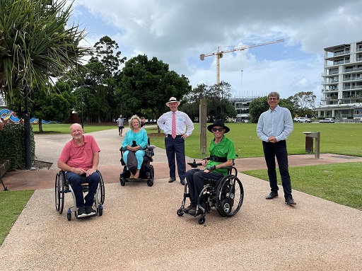
The trial, in partnership with Briometrix and Spinal Life Australia, will use devices installed on wheelchairs operated by specially trained local ‘Pilots’ to track routes from Maroochydore to Mooloolaba.
Briometrix’s technology collects information about footpath conditions, access to public transport and parking, amenities, boardwalks, beach access and more.
“Equity and inclusion are key principles we value at council and in our community, which is why this pilot project is essential in identifying accessible routes suitable for everyone,” said Sunshine Coast Council Mayor, Mark Jamieson.
“People with limited mobility, whether permanent or temporary, often find it a challenge to move around the Coast due to a lack of maps and wayfinding information about accessible routes. That’s about to change.”
He said the pilot project represents a departure from dated paper-based accessibility maps, adding: “Once the data goes live on our website, each and every one of us can find our best path, given our needs and ability.”
Data combined with lived experience
The local Pilots will use Briometrix’s dedicated sensors and software to capture the survey data along with a continuous georeferenced video stream.
One participant will use an electric wheelchair to measure factors such as street inclines and slopes and the effort level they require. Others will use iPads and video cameras to map and mark the structures, kerb ramps, crossings and trip hazards. Pilots also add their local knowledge, lived experience and insights to the information collected.
Mobility chief pilot Bevan Kearsley commented: “While able-bodied people can simply decide where they want to go, people living with limited mobility face daily challenges in finding viable routes to go places where they’ve not previously been.
“Many spend hours in planning their route to ensure their way will not be blocked or inaccessible, because most have previously experienced having to abandon their journey to return home.”
The mobility maps are expected to go live in April.
Other local governments and transport authorities that are using Briometrix Mobility Maps include Brisbane, Townsville, Queensland Department of Transport and Main Roads, Wollongong, Sydney, Melbourne, Public Transport Victoria, and Indianapolis Public Transportation Corporation.
Image: Bevan Kearsley, Kay MacLean, Mayor Mark Jamieson, Dane Cross, and Cr David Law.