Report highlights the world’s leading cities for walkability
20 October 2020
by Sarah Wray
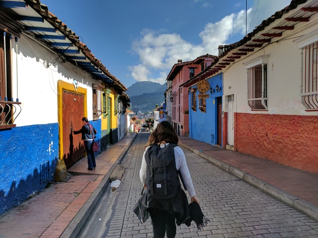
Bogotá, Paris, Hong Kong and London are ranked among the best cities in the world for key walkability indicators in a new report from the Institute for Transportation and Development Policy (ITDP).
Pedestrians First includes practical tools that allow urban planners and city officials to assess the inclusivity of their cities’ transport systems as well as the walkability of their neighbourhoods and streets. It also provides walkability data for almost 1,000 metropolitan areas worldwide.
ITDP says the report is the first analysis to measure walkability in cities globally. It comes as cities have seen a drop in public transport use amid COVID-19 and are working to ensure this doesn’t result in a surge in car traffic.
“COVID-19 has dramatically exposed our inequalities at every level, including our options for travel. Those higher on the income scale tend to have access to both walkable neighbourhoods and transport, while those who are lower have neither,” said Heather Thompson, CEO of the Institute for Transportation and Development Policy (ITDP). “In order to provide safe and inviting walking conditions for all city residents, it is essential to shift the balance of space in our cities away from cars, providing more travel options for people. We have so much to gain — from cleaner air to better health to stronger local economies and deeper bonds within communities, and we all need that now more than ever.”
Elements of a walkable city
Pedestrians First includes rankings for “the most telling” walkability indicators, based on global open-source data. These include:
- Proximity to services measures the proportion of the population living within one kilometre of both healthcare and education. Closer social services mean better walkability. The top five major cities (with more than five million inhabitants, based on metropolitan areas as defined by the European Commission’s Urban Centre Database) are Paris, France; Lima, Peru; London, Great Britain; Santiago, Chile; and Bogotá, Colombia.
- Proximity to car-free places measures the percentage of the city’s population living next to a car-free public open space. The leading major cities are Hong Kong, China; Moscow, Russia; Paris, France; Bogotá, Colombia; and London, Great Britain.
- Small city blocks make it easier for people to walk directly to their destinations without a detour. On the block density indicator, the best ranked major cities are Khartoum, Sudan; Bogotá, Colombia; Lima, Peru; Karachi, Pakistan; and Tokyo, Japan.
The report finds that US cities tend to rank low on walkability indicators due to urban sprawl. Overall, the researchers conclude that New York City, Boston, San Francisco and Baltimore are the four most walkable major US cities (urban areas with over 500,000 residents). The US cities with the lowest overall scores are Orlando, Atlanta, Indianapolis and San Antonio. The report notes that many US cities are well-positioned to improve their walkability by adopting policies that counter urban sprawl and encourage the mixing of residential and commercial spaces.
Pedestrians First includes tools to help policymakers assess the walkability of their city’s streets and neighbourhoods. This includes measuring ways that their city’s transit system supports vulnerable travellers, especially babies, toddlers and their caregivers. Recommendations and resources to improve walkability are also provided.
Next steps
ITDP also outlines several “best practice” examples from neighbourhoods around the world.
For example, Pune’s Jangali Maharaj road redesign prioritised pedestrians and cyclists by streamlining haphazard parking conditions, implementing signage, building wide sidewalks and crosswalks, and creating dedicated spaces for vendors to sell and for children to play. In Quartier Massena in central Paris, all blocks have street-level retail that opens up to the sidewalk. This encourages safe pedestrian and cyclist mobility, the report notes.
“Walkable cities don’t happen by accident,” said D. Taylor Reich, Research Associate at ITDP and the primary author of the guide. “Policymakers first have to understand the problems that car-oriented planning has caused. Then they can take specific steps: from planning dense, human-scale, mixed-use developments to equipping streets with benches, wide sidewalks and shade. Pedestrians First gives city planners and officials everything they need to get started.”
The data analysed was gathered before the pandemic and therefore does not include the street repurposing that many cities have undertaken during it. ITDP plans to incorporate more recent data when circumstances stabilise, Reich said.